Track Larval Habitats and Larval Control Applications
Field technicians can use GPS coordinates to collect data related to larval habitats and larvicide applications. Data can include marking a location that was visited, noting if a location had larval activity, or tracking how much product was applied to a given area.
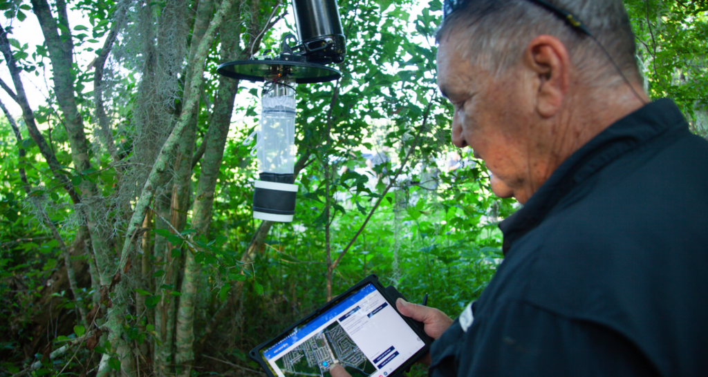
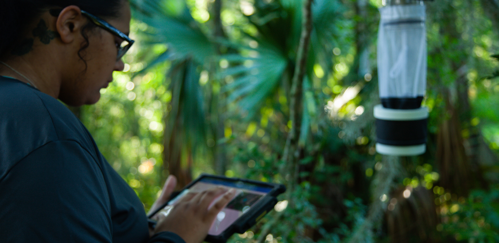
Process Surveillance and Disease Monitoring Data
 Using GIS can provide a clear idea of what is happening in the mosquito populations in any given area. First, trap locations can be recorded and added to a database. Next, mosquito counts and species identified can be populated for each location. Then, disease testing can be inputted for each trap and mapped on an ongoing basis. Additionally, service requests can be logged and mapped to help identify problem areas.
Determine Adulticide Application and Treatment Exclusion Areas
By tracking the mosquito populations, managers can make educated decisions on whether control measures are needed as well as when and where to make adulticide applications. The data allows mosquito control technicians to set parameters and load a base map for each mosquito application mission. During a ground mission, a technician’s truck has a GPS controlled variable flow Ultra-Low Volume (ULV) sprayer and a PC within the cab that displays a moving map and mission database to record the GIS data. All aspects of adulticide applications (ground or aerial) can be recorded including but not limited to time and date of application, the application rate, the product utilized, the amount of product applied, and the specific route with notes on exclusion areas.
Regulatory Compliance
To maintain individual and corporate compliance and licensing with multiple government agencies and jurisdictions is a daunting task. By accurately recording and mapping all aspects of a program, maps can be used to assure regulatory compliance and streamline requirements for initiatives like NPDES permitting.
Inventory Management
When ULV application equipment is coupled with GPS tracking units and on-board GIS monitoring systems, accurate chemical use is recorded. This allows program managers to know exactly how much adulticide is being used during every spray mission, which in turn provides them with the data they need to manage their product inventory efficiently. In larvicide applications, GIS data provides accurate area measurements so technicians know how much product to apply at any given site and managers know how much product they need to have on hand to treat all the sites in their program.
Public Education
By mapping public health risks, associated with disease monitoring in mosquito populations, GIS can support a community’s efforts to communicate if there is a mosquito-borne disease concern in a given area.
Emergency Response
Federal, state, and local governments use GIS to aid in emergency response efforts. GIS has played an integral role in controlling mosquito outbreaks after tropical storms, hurricanes, and intense flooding.
![]() Since 1992, Vector Disease Control International (VDCI) has taken pride in providing municipalities, mosquito abatement districts, industrial sites, planned communities, homeowners associations, and golf courses with the tools they need to run effective mosquito control programs. We are determined to protect the public health of the communities in which we operate. Our mosquito control professionals have over 100 years of combined experience in the field of public health, specifically vector disease control. We strive to provide the most effective and scientifically sound mosquito surveillance and control programs possible based on an Integrated Mosquito Management approach recommended by the American Mosquito Control Association (AMCA) and Centers for Disease Control and Prevention (CDC). VDCI is the only company in the country that can manage all aspects of an integrated mosquito management program, from surveillance to disease testing to aerial application in emergency situations.
Since 1992, Vector Disease Control International (VDCI) has taken pride in providing municipalities, mosquito abatement districts, industrial sites, planned communities, homeowners associations, and golf courses with the tools they need to run effective mosquito control programs. We are determined to protect the public health of the communities in which we operate. Our mosquito control professionals have over 100 years of combined experience in the field of public health, specifically vector disease control. We strive to provide the most effective and scientifically sound mosquito surveillance and control programs possible based on an Integrated Mosquito Management approach recommended by the American Mosquito Control Association (AMCA) and Centers for Disease Control and Prevention (CDC). VDCI is the only company in the country that can manage all aspects of an integrated mosquito management program, from surveillance to disease testing to aerial application in emergency situations.